Retiring teacher, coach urges Colony grads to ‘find their 68’
By Jeremiah Bartz Frontiersman.com A football coach using a hockey reference as the centerpiece for his keynote address may


WASILLA — For the first time in more than three decades, the Mat-Su Borough’s flood maps have been updated. In 1985, the borough joined the National Flood Insurance Program and adopted the only maps the Mat-Su has ever used in establishing federal guidelines on floodplains and floodways in the region’s three watersheds — the Matanuska, Lower Susitna and Anchorage — which feed into the area’s rivers, creeks and streams.
Since that time, the borough has experienced not only a number of flood events, but also substantial population growth. Technology has also improved substantially over the time period. Mat-Su Development Services Manager Alex Strawn said the original maps were drawn up using the best knowledge and practice standards available at the time. Today, extreme map accuracy can be obtained using a combination of boots-on-the-ground surveys and historical flood data, as in the originals. However, the introduction of LIDAR (Light Detection and Ranging), which uses a pulse laser, generates pinpoint, three-dimensional information including detailed surface characteristics.
“Data in 1985 was rather crude compared to what we have now,” Strawn said. He said over the years, serious flaws in the borough’s floodplain maps were found. In 2011, the borough overlaid new data on existing maps and found the overall picture “was nowhere close to being right,” Strawn said. “There were examples where it didn’t match the (land) contours, and sometimes didn’t follow rivers.”
In 2013, the borough joined forces with the US Army Corps of Engineers to remap the Butte area, one of the Mat-Su’s worst erosion-prone areas. Strawn said collected data much better matched the actual lay of the land.
“Erosion was a really hot topic. We saw how beneficial (remapping Butte) was to get accurate data. We asked FEMA (the Federal Emergency Management Authority) to help,” Strawn said. He said with the borough’s immense size, officials told the feds if it wanted the Mat-Su to enforce federal flood guidelines, it would have to help secure the needed data. With that began the largest federal mapping project of any local municipality in the country.
Strawn said compiling the data and establishing the new mapping system is a five-year project. As noted, it began in 2013 and Strawn said the timeline is right on schedule to meet that date. The project began with FEMA “scoping things out” to determine the borough’s needs. In addition to terrain, things like the frequency of earthquakes, wildfire and landslide susceptibility figured into the equation. After that, both sides sat down and made sure everyone was on the same page with all aspects of the collected data.
“(FEMA) got us some early data about two years ago. (Recently), they came out with preliminary data which can have regulatory implications,” Strawn said. “This is the data that’s ready to send out to the public.”
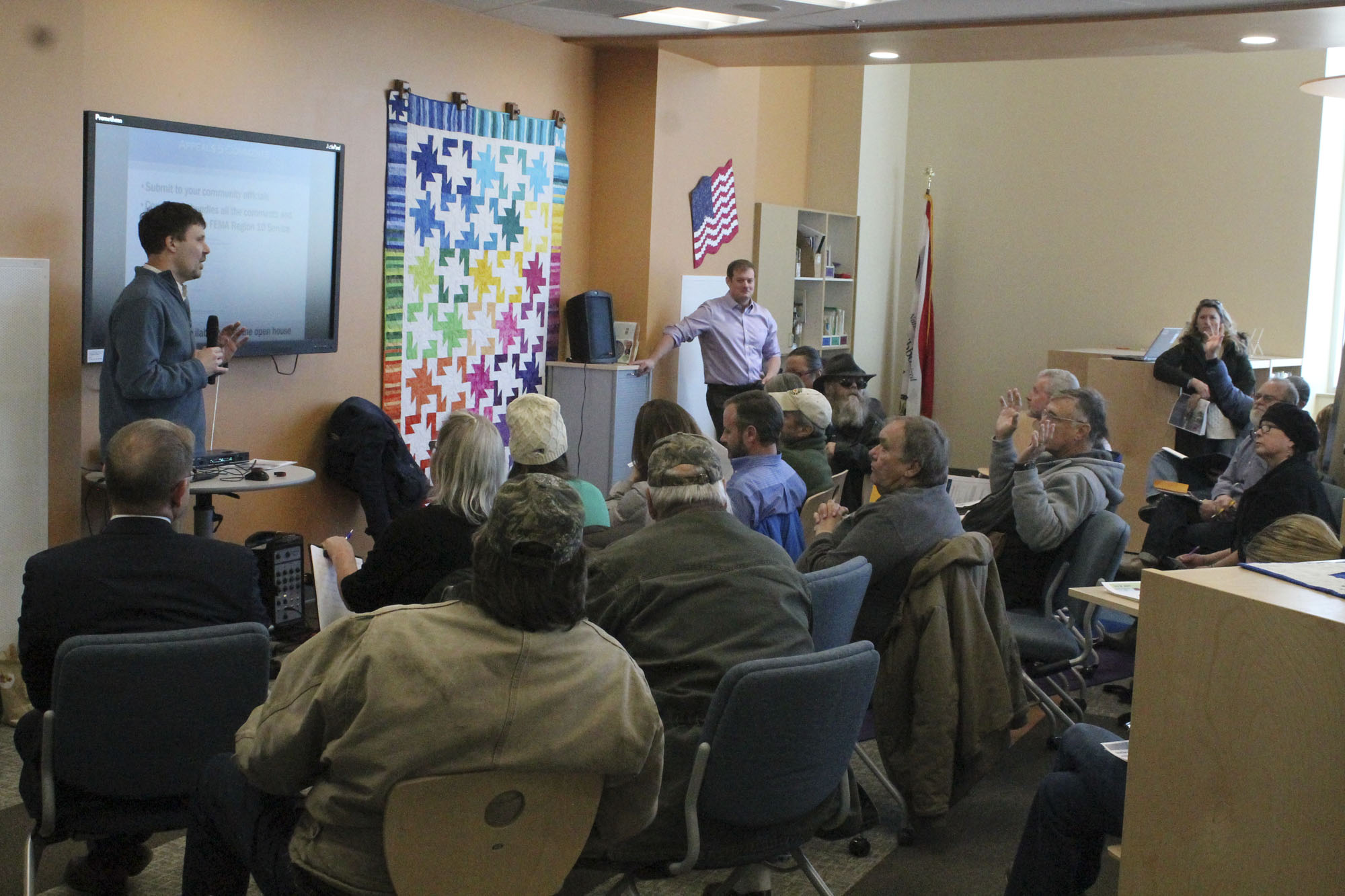
That’s where the process currently sits. Strawn said the four public hearings on the proposed changes were held last Wednesday and Thursday in Willow, Meadow Lakes, Wasilla and Butte-Palmer. There borough and FEMA officials presented the preliminary data and associated changes that could become the new norm regarding flooding.
Strawn noted that the borough mailed letters to almost 4,000 landowners in affected areas. By far, he said, the biggest winner in the update is Butte, where approximately 1,000 buildings in the current floodplain are pegged to be removed under the preliminary maps.
“In 1985, the map was made based on a drawing and the best information they had. There was a flood in (mid-August of) 1971 and at the time there was a lake with a natural dam up by Sutton,” Strawn said. “The dam broke and flooded much of Butte.” Strawn said the lake emptied into Bodenburg Creek. “It was very memorable for those who were here at the time. But that lake no longer exists and it’s not feasible for that flood to happen again. (Because of that,) many, many homes are coming out of the floodplain”
Strawn said on the flip side, there are approximately 100 buildings not in the existing floodplain map that would be if the new preliminary data holds up .Many of those are along the Little Susitna River north of Wasilla. Some of those individuals showed up at the public hearings with expected concerns, Strawn said, adding there will be a 90-day public comment and appeals period regarding the proposed changes . He said the appeals part is straightforward.
“The comments process could be a different story. It could be the canary in the coal mine,” Strawn said. “There might be problems or missing data.”
Following the initial public hearing process, if things remain on track, the next stop would be the borough assembly. Strawn said that process would start with the Mat-Su Planning Commission before a presentation to the assembly as a whole. More public hearings are part of that process as well.
“Ultimately it will be adopted,” Strawn said. He said the borough has no choice but to adopt some final form of the new data. Flood-prone municipalities that do not do so within six months of the final draft are suspended from the federal flood insurance program — the only one in country.
To help residents determine whether their property is located in either an existing floodplain or floodway, or if it would be if the new data holds up, the borough has a wealth of information online. Visit https://www.matsugov.us/spotlights/floodway-mapping-update. There, visitors will find directions on how to use a detailed, interactive map. Another site chock full of related information can be found at https://www.matsugov.us/flood-plain-development-info.

By Jeremiah Bartz Frontiersman.com A football coach using a hockey reference as the centerpiece for his keynote address may

Frontiersman.com With its headquarters in Wasilla, the Frontiersman has been a primary source of news for the Matanuska-Susitna

By Katie Stavick Frontiersman.com The next generation of leaders took flight this week as the Houston High School Class

By Kyle Wilkinson For the Frontiersman Keynote speaker and Carry the Cure President Bill Pagaran’s words boomed through the