Retiring teacher, coach urges Colony grads to ‘find their 68’
By Jeremiah Bartz Frontiersman.com A football coach using a hockey reference as the centerpiece for his keynote address may


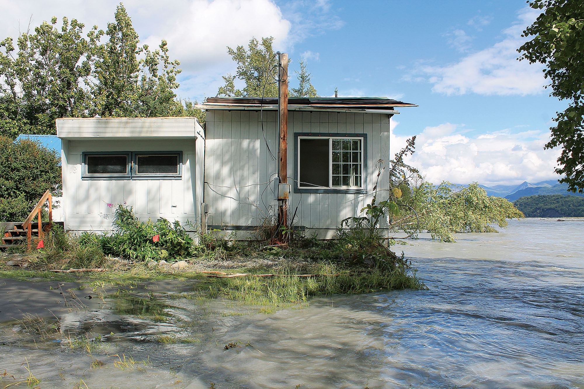
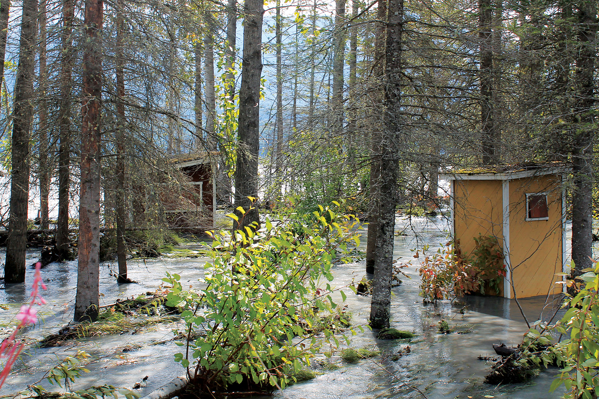
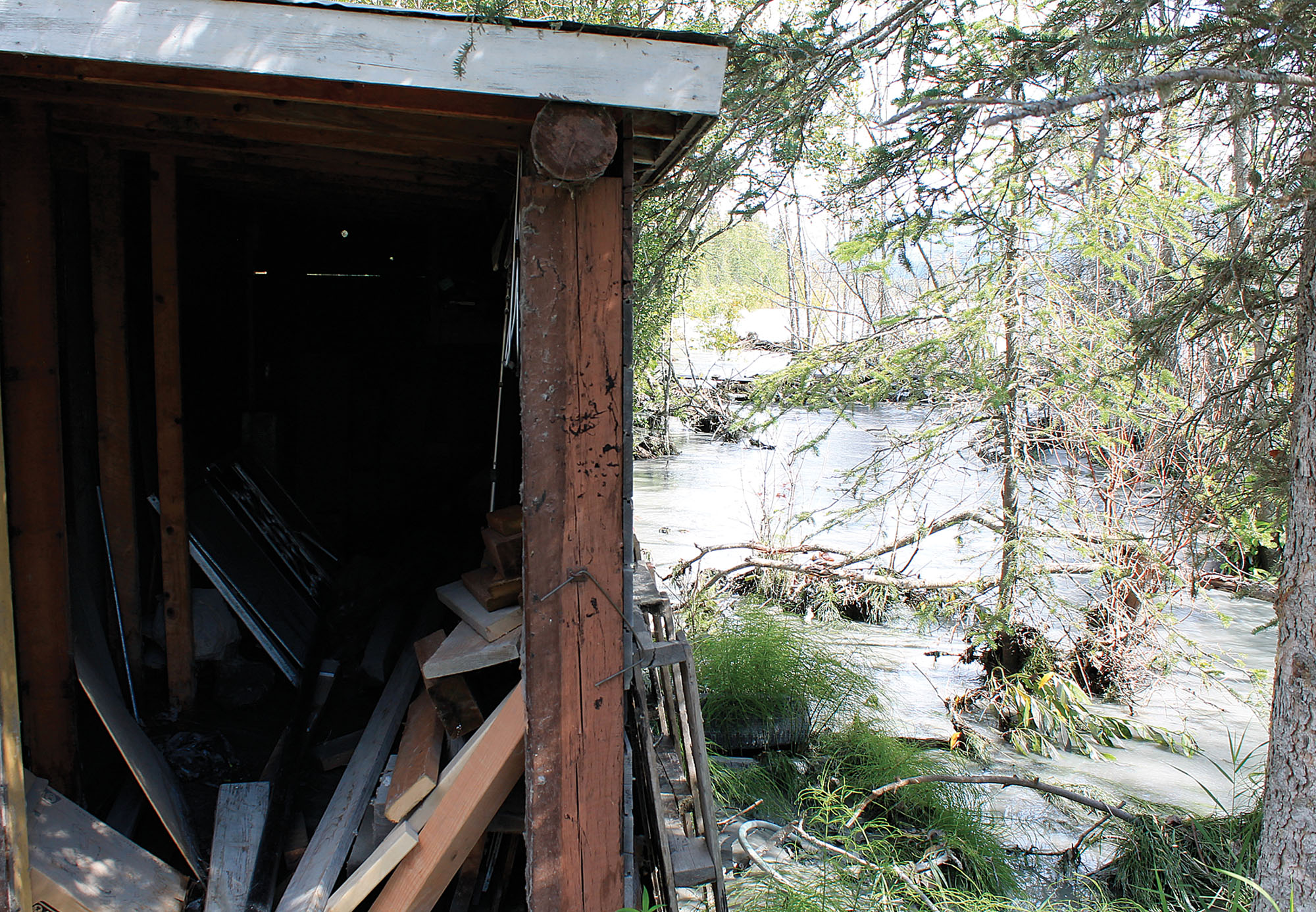
SUTTON — The Matanuska River’s rapid erosion of sandy soil along its banks took homeowners and some government officials by surprise this week.
Officials with the Alaska Department of Transportation and Public Facilities determined that the highway connecting the Valley with the Copper River Basin was at risk from the ravenous river, according to a press release issued Tuesday. The river’s erosive march has devoured at least one home this summer, and threatens as many as half a dozen more properties and structures near a bend in the river. Some homeowners in the area could do little more than wait to see whether the river would take their property away.
To protect the highway, officials say they plan to dig a 400-foot-long trench parallel to the road, and fill it with stones.
“As the river moves toward the road, the buried armor stone will be exposed and protect the road embankment from the force of the river,” the press release reads in part.
The effort to save the road, comes even as some homeowners in the ill-fated stretch waited to see whether the river would sweep away their houses and property.
Alaska Rep. Jim Colver said that while state action to save a road might anger homeowners the DOT can’t work outside of its particular sphere.
“It’s a shame to sit back and watch,” he said. “The cavalry’s not coming.”
And while government departments may be unable to step in and help, that hasn’t stopped Colver from trying to push things forward on his own, coordinating private contributions into potentially relocating a house owned by Colleen Boyle away from the encroaching waters to the other side of the Glenn.
“That’s what I’m working on for the other folks,” he said. “There seems to be good support for that. It’s going to come down to whether that’s what she wants or not, then we start work right away.”
“It’s basically a barn-raising in reverse,” Colver added.
Borough assembly members, staff, and state officials met with the Sutton Community Council Wednesday evening to discuss progress along the road, said borough emergency manager Casey Cook. The meeting went relatively well, he said.
“I think we were able to answer their questions,” Cook said. “I don’t think a lot of the answers were what they wanted them to be.”
The water near the imperiled houses had receded Friday morning, he said, even though National Weather Service gauges continued to show river readings at or near flood stage. The most publicly cited gauge — measurements taken near the George Palmer Memorial Bridge — is of limited use in determining how the river is behaving in the Sutton area, because the river flows through a narrow bedrock-lined ravine in that area, which makes the river deeper.
“I talked with them (the National Weather Service) last week about the disparate readings between the upper Mat River and the Lower Mat River, so they were going to go out and keep a more active eye on, and then see about putting one in the more in the middle of the river. Just because it’s showing action stage at the lower Mat doesn’t necessarily mean anything,” Cook said. “It’s more, not the depth of the water right now, it’s just the velocity of the water, and it’s gotten into a bunch of much looser soils so it’s eating away at a greater rate.”
Contact Brian O’Connor at 352-2269, brian.oconnor@frontiersman.com, or on Twitter @reporterbriano.

By Jeremiah Bartz Frontiersman.com A football coach using a hockey reference as the centerpiece for his keynote address may

Frontiersman.com With its headquarters in Wasilla, the Frontiersman has been a primary source of news for the Matanuska-Susitna

By Katie Stavick Frontiersman.com The next generation of leaders took flight this week as the Houston High School Class

By Kyle Wilkinson For the Frontiersman Keynote speaker and Carry the Cure President Bill Pagaran’s words boomed through the